The involvement of MBGS personnel with coal basins in Antarctica goes back to 1964 when our company’s founder, Dr Cliff McElroy, made his first field trip to the Transantarctic Mountains in 1964.
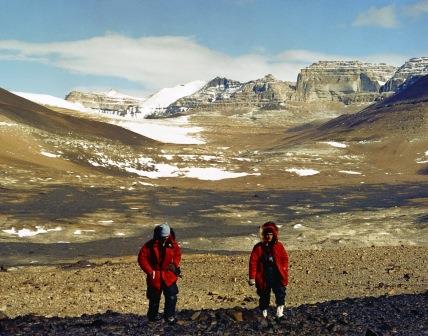
A few years later in 1966, Dr John Bryan, MBGS co-founder and former Managing Director, was part of the 3 man team including Cliff McElroy and Toby Rose that spent many weeks camped out in polar tents in the Dry Valley region of the Transantarctic Mountains, carrying out a local geological mapping survey of Arena Valley.
In the late 1970s, a proposal by Cliff and Toby to initiate a major regional geological mapping project in Antarctica was supported by the American National Science Foundation and the first expedition in 1980 was funded by the United States Antarctic Research Programme (USARP). Cliff and Toby, together with Kerry Whitby, MBGS’ current Managing Director, returned to the Arena-Beacon Valley area to commence the regional mapping project. The 1:50,000 scale regional geological map covered approximately 1,500 km2 in the Arena-Beacon Valley area. The geological map was found to be useful for other scientific disciplines such as biologists studying lichen occurrences in Antarctica but, in particular, it provided the basis for a decent assessment of the coal resources in that part of the continent.
In 1982 John and Kerry were invited to expand the mapping project into other parts of the Dry Valley region by the New Zealand Antarctic Research Programme (NZARP), specifically to map and sample coal seams in the Dry Valley Region that had been reported by earlier explorers, only some of whom were geologists. The need to assess the extent and quality of the coal seams was driven by an upcoming meeting of the Antarctic Treaty Nations that was to consider and make recommendations relating to exploration for minerals on the southern landmass. Earlier reports of widespread occurrences of thick coal seams had led to very optimistic assessments of likely coal resources in Antarctica and the prospect of mining coal on the continent was under consideration in the USA and the Soviet Union. Our geological mapping project was designed to improve the understanding of the regional geology and we were able to confirm that the coal seams were much thinner than previously reported, lenticular in nature and most were heat affected due to the extensive doleritic sills that intruded the stratigraphic sequence. Through this mapping project it was concluded that although there are numerous coal occurrences in Antarctica, the coal resources are very small and not considered to present a viable mining prospect.
NZARP continued to support the mapping project for a further 12 years until the project was completed. A total area of approximately 8,000 km2 was eventually mapped, providing a huge geological database and level of understanding of the geology in that part of Antarctica. The success of that basic geological work led to a clear and accurate recognition of the nature and extent of coal occurrences in Antarctica. That work played a part in maintaining the magnificent, pristine nature of the continent and this has always been a source of great pride to all involved in this project, and to MBGS in particular.